Posted date
An Environmental impact Assessment (EIA) is an assessment of the possible impact—positive or negative—on the environment when a new activity/program is introduced in an area. The assessment considers natural, social and economic aspects.
The purpose of the assessment is to ensure that possible environmental impacts are considered before deciding to go ahead with the program or designs the program to avoid possible negative impact.
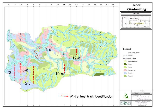
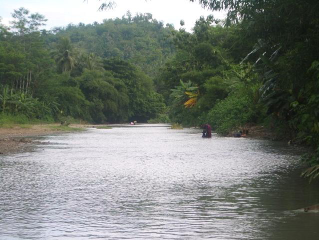
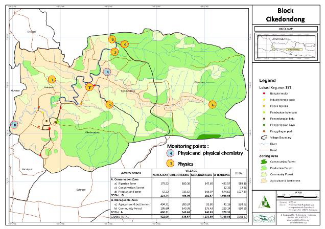
EIA activities started in Block Cikedodong (consists of 4 villages) with identifying environmental factors such as river conditions, biodiversity (vegetation and wild animals) in each land category (e.g. forest, shrub, garden, paddy field, settlement).
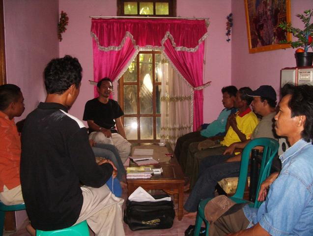
Our approach is participatory meaning we work through local institutions and farmers, in fact the process of the Assessment has proven to be an efficient education process which teaches farmers to determine the quality of their environment and to manage it.
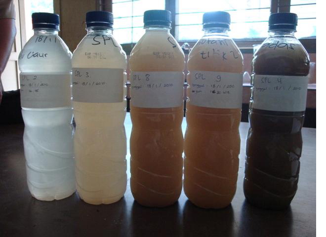
We established 9 SPL (Stasiun Pemantauan Lingkungan/Environment Monitoring Points) to observe physio-chemical aspects (in the river), 6 track for wild animal monitoring, and 44 plots for vegetation monitoring.
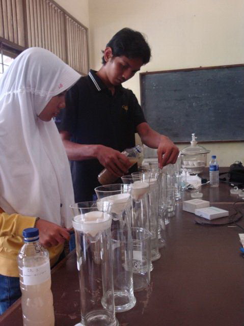
We work with the laboratorium of Banyumas Agricultural School to analyse physical samples and with the University of Soedirman-Purwokerto, Faculty of Biological Science/Environment Lab. for chemical analysis (BOD/COD and pesticide contents)
9 Environment monitoring points were established in Block Cikedondong in relevant rivers/streams.
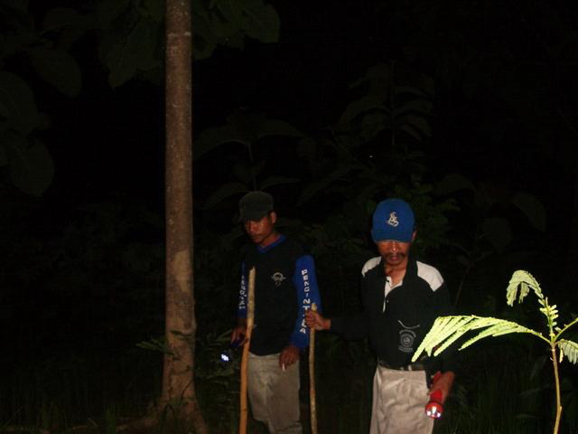
6 Wild animal identification tracks were established in Block Cikedondong representing various land cover/ecological types
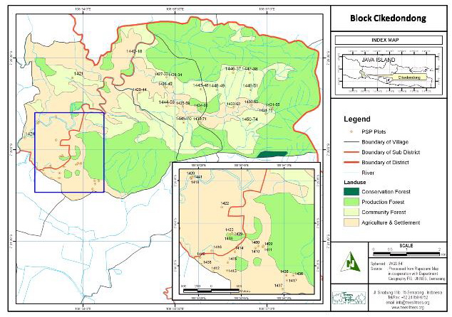
44 of Permanent Sample Plots for vegetation identification and monitoring, represented of 4 types of Silviculture
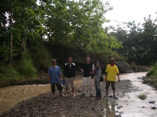
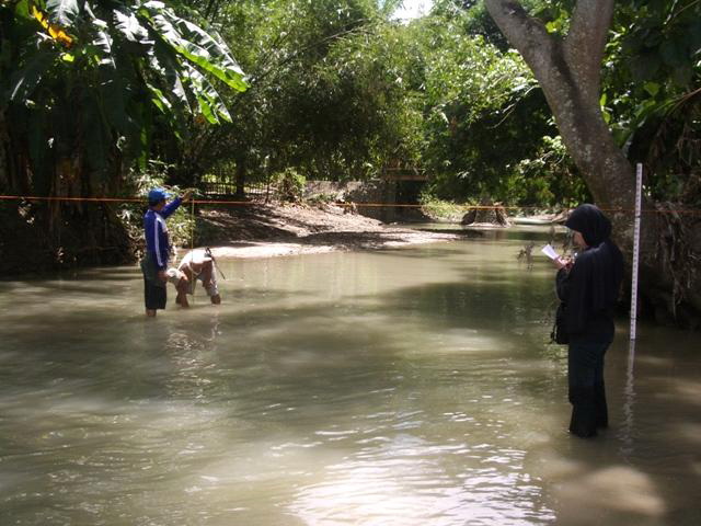
The EIA team,consists of trees4trees staffs and farmer groups. EIA team (farmers: Kohar, Kholil, T4T : Aris,Novi, Field Coordinator: Badrun) at Watubelah river, before arriving at the upper course to measure of water quality
Cihaur river is largest river in Block Cikedondong-Cilacap and is part of the scope of EIA study in Cilacap
Kedungwadas (monitoring point no 4) is the second largest river in Block Cikedondong; the EIA team is here measuring the waterflow rates
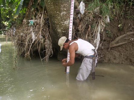
Dulwarsito, farmer member of Kedungwadas sets up meter stick in monitoring point no 4 to measure the waterlevel at Kedungwadas river
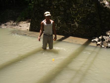
Dulwarsito, measuring water flow use a pingpong ball and stop watch as a simple method which is introduced to the farmers. They also learn to analyse the results.
Sample of water from 5 monitoring points to be analyzed of total suspended solids (TSS) which is an important factor in physical water quality
Novita with a student practice measuring TSS at the laboratorium of Kalibagor Agriculture School
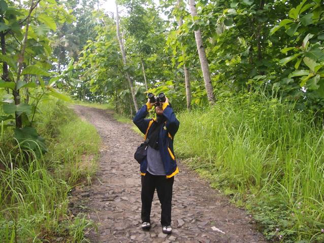
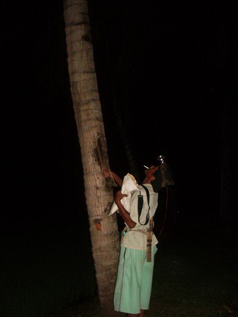
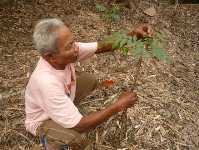
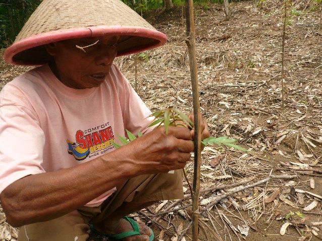
Badrun, field coordinator in block Cikedondong in night observation of wild animals.
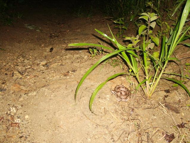
Gibug snake (Agkistrodon rhodostoma), one of the nocturnal animals in Block Cikedondong found in track no 10-m.
Bird watching in block Cikedondong found 20 bird species. There were 9 birds species categorized as Rare, Treatened, Endangered (RTE)
Tono, a farmer member of Cikedondong is also a local hunter. He taught us where to look and how to look in the night oberservation of wild animals.
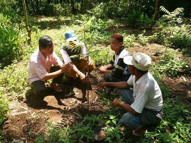
Tree Planting
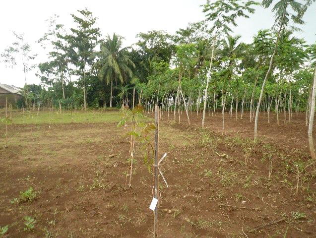
446.025 trees were targeted for planting in December-January 2009-10. Some of areas delayed the schedule of planting because the rainy season started late. But in January planting got under way, first with West-Central Java and later in the month in East-Central Java.
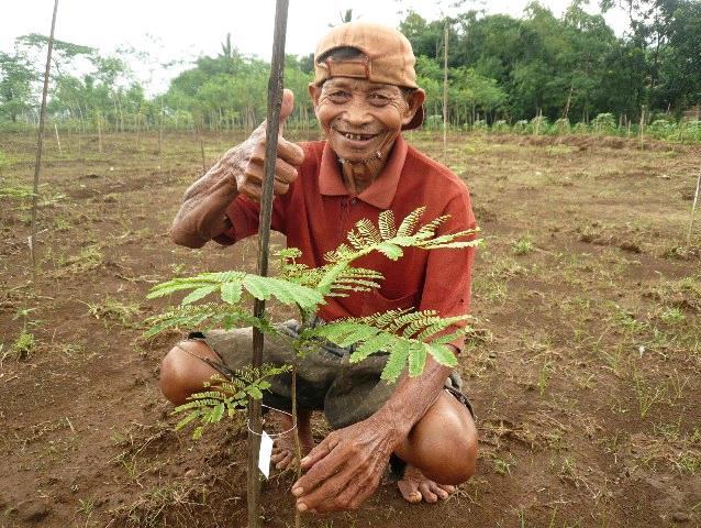
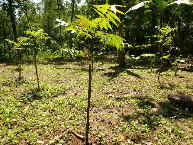
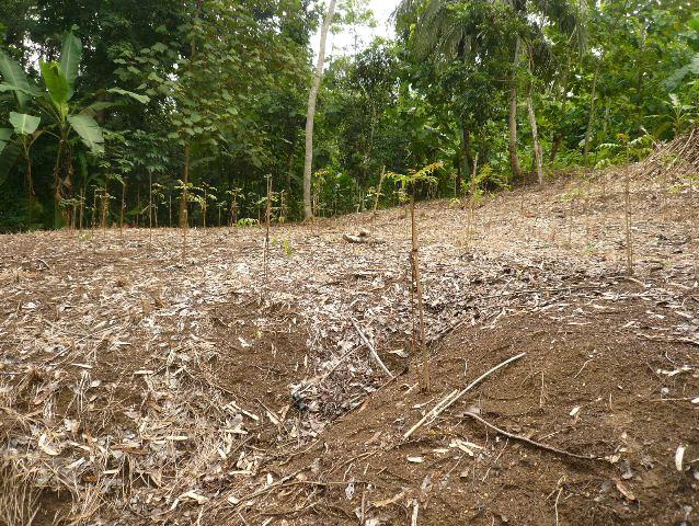
Plot no 30 in Village Padamara_District Purbalingga, planted 650 Suren trees owned by Rislam Sutrisno. Sakhidi, a farmer in Village Padamara District Purbalingga with his Sengon trees just planted in his plot (plot no 44). Totally 650 Sengon trees were planted by Sakhhidi.
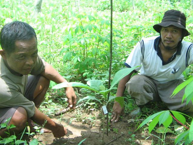
Kamil, T4T field staff, discusses with Sarjono, the farmer group manager of Patemon, Purbalingga. Suren trees planted in plot no 57 at Village Patemon, Purbalingga
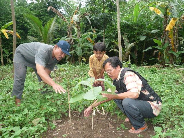
Sugiyono, field coordinator Village Kaliori, District Banyumas with Supardi, a farmer who got 90 teak trees. Teak trees at plot no.19 owned by Pujiono, a farmer in village Kaliori, planted in between rice plant. Totally 450 trees were planted in that area
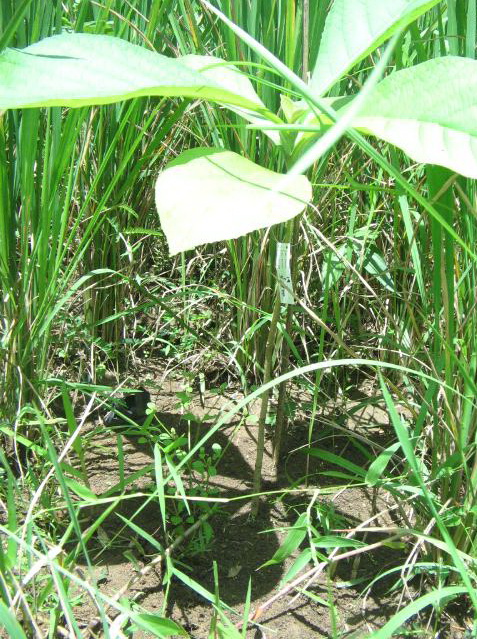
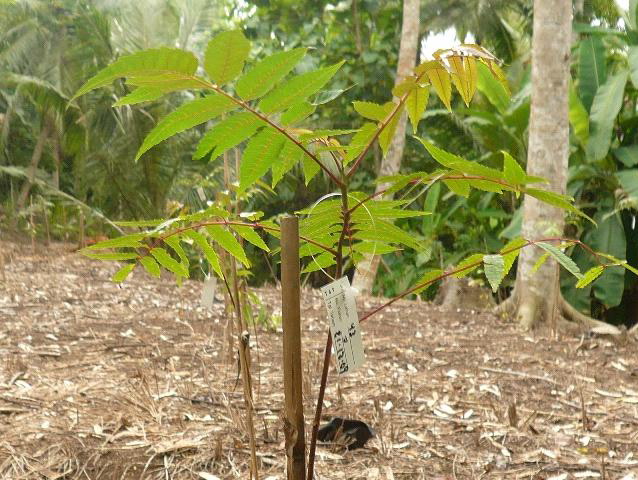
Suren trees planted in plot no 15 owned by Sahrudin a farmer in Village Bulaksari, District Cilacap. He got 233 trees from the program. Tree labels indicate ownership and location of planting
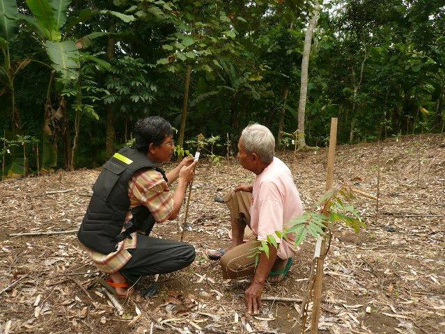
Kamil, Trees4Trees field staff, explains to farmer how the tree labels are applied. Supervising teak trees after planting in plot no 7, owned by Sakur at Village Bulaksari, District Cilacap.
Sahrudin, a farmer in village Bulaksari, Cilacap, planted trees beside supporting poles. Labeling of seedling after planting.


Add comment